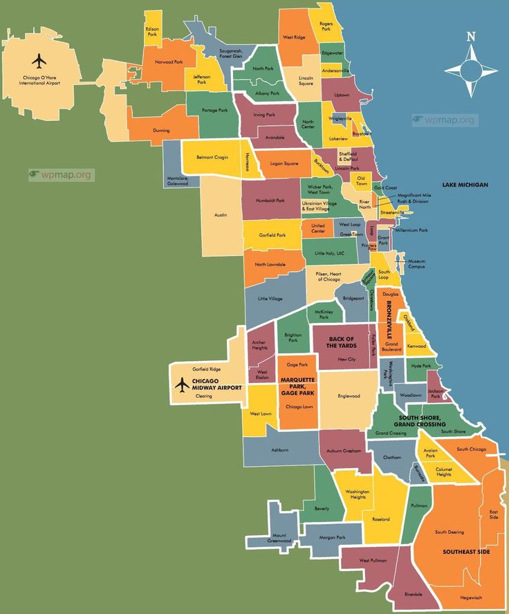
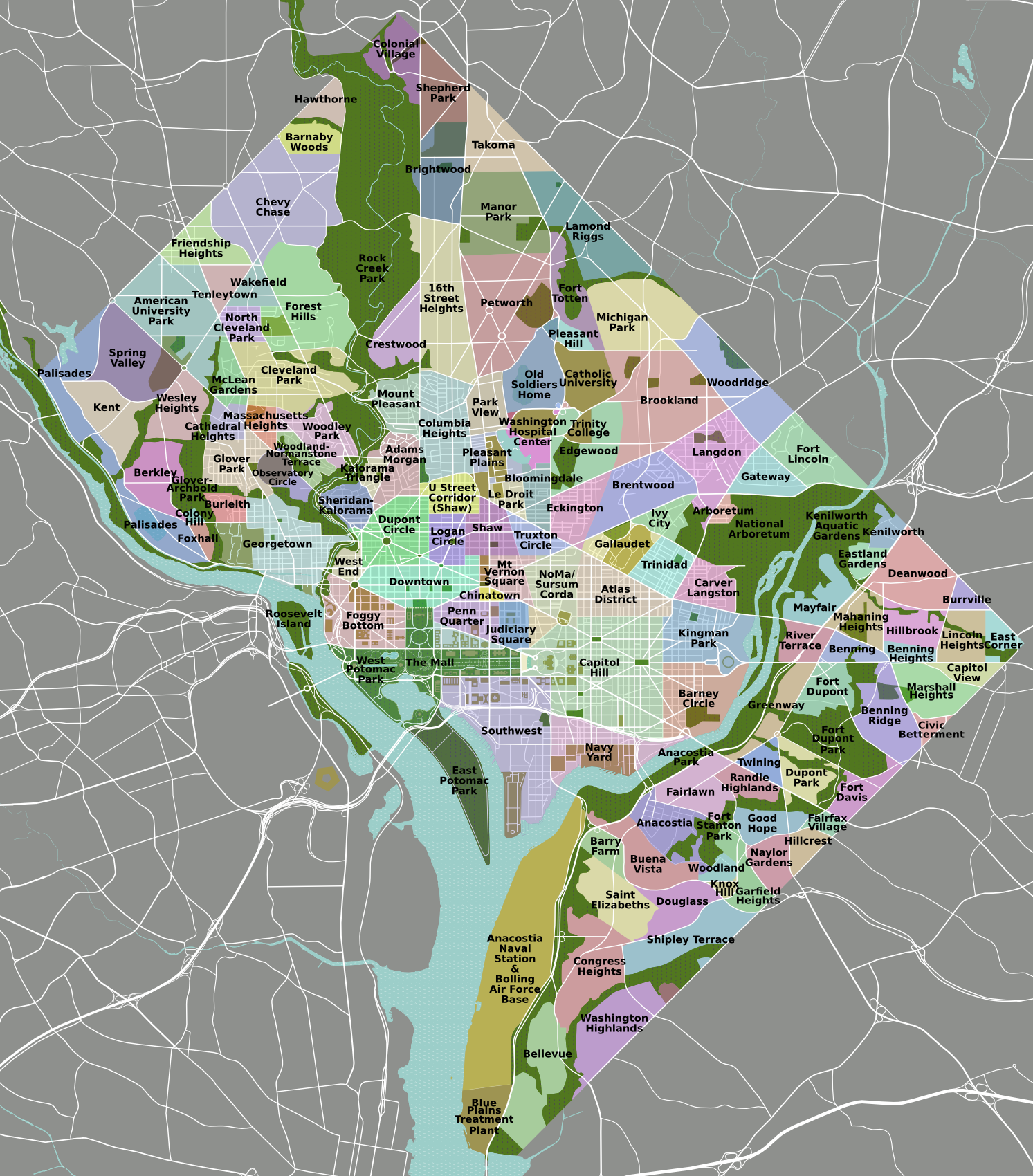
So here’s the thing about neighborhoods. In some cities, neighborhoods have official names, and precise boundaries, and even signs telling you which neighborhood you’re in — often with the name of the mayor attached (you might wonder why that’s done, but you probably don’t have to wonder). In other cities neighborhoods are merely informal, with borders that are squishily defined. Chicago and DC are good examples of the former, as you can see in the neighborhood maps below; Boston is a hybrid, where a neighborhood like Charlestown is precisely delimited but where nobody quite agrees where the border is between Dorchester and Roxbury — and which of those Grove Hall is in — and whether Mission Hill is its own neighborhood or whether it’s part of Roxbury. Or is it in JP?
Anyhow, I have been asked about the neighborhoods of Rose City, the semi-fictional city on my model railroad layout. Pending a rendering as a map, here is a listing of the neighborhoods:
- Center City is the oldest neighborhood, in the northwest corner of Rose City. Northwest corner? Why the name “Center City”? Well, it’s similar to what happened with South Boston, which is (now) in the northern half of Boston. Borders change as cities grow, but names rarely change. Center City is the only neighborhood north of the river,
- Immediately across the river is Commerce Way. I know, it sounds like a street, not a neighborhood, but that’s life. The Chamber of Commerce insisted.
- The city expanded both west and south of Commerce Way. Directly to the west is College Town, home of both White Rose University and Sekhmet College.
- Further west we have Ptah Village, annexed by Rose City in 1909, keeping its name even though it was no longer a village.
- Returning to Commerce Way, we see to the south another neighborhood that kept its old name when it was annexed in 1911: Pine Village. Known for its pine trees (what a surprise), it started attracting home builders in the 1940s and eventually its southern half split off to be a new neighborhood. The unimaginative city councilors decided to call it Newtown.
- Continuing southward and up a steep hill, we get to a leafy area that used to feature orchards in the old days. No one was surprised when the residents chose to call the neighborhood Orchard Heights.
- West of Orchard Heights, two rural neighborhoods, North Woodland and South Woodland, became more and more suburban through the decades, so everyone started calling them The ’Burbs. When they merged, that became their official name.
- Finally, south of The ’Burbs were the power plants, factories, and other industrial facilities. They picked PowerTown as the official name of the ninth and last neighborhood. Not really a neighborhood, since almost nobody actually lived there, but c’est la vie.
For real-world comparison, here are neighborhood maps of Chicago and Washington DC:
- Wikipedia claims that there are “there are 178 official neighborhoods in Chicago.” Wow, that’s a lot! And note that it says “official.” I found the map very useful when reading Sara Paretsky.
- Similarly, I badly needed a neighborhood map of Washington DC while reading Vera Kurian, especially when I discovered that my mental map of Georgetown was all wrong and I didn’t have any idea about NE. Apparently there are 131 neighborhoods — fewer than Chicago, but then again it’s a different sort of city:
Categories: Model Railroading
