 OK. We know that Boston traffic is a mess. We also know that large swaths of people are unwilling to take the T for a variety of reasons, many of which reflect legitimate frustrations. So here we have a number of ideas: one from 1947 and 40+ from 2019.
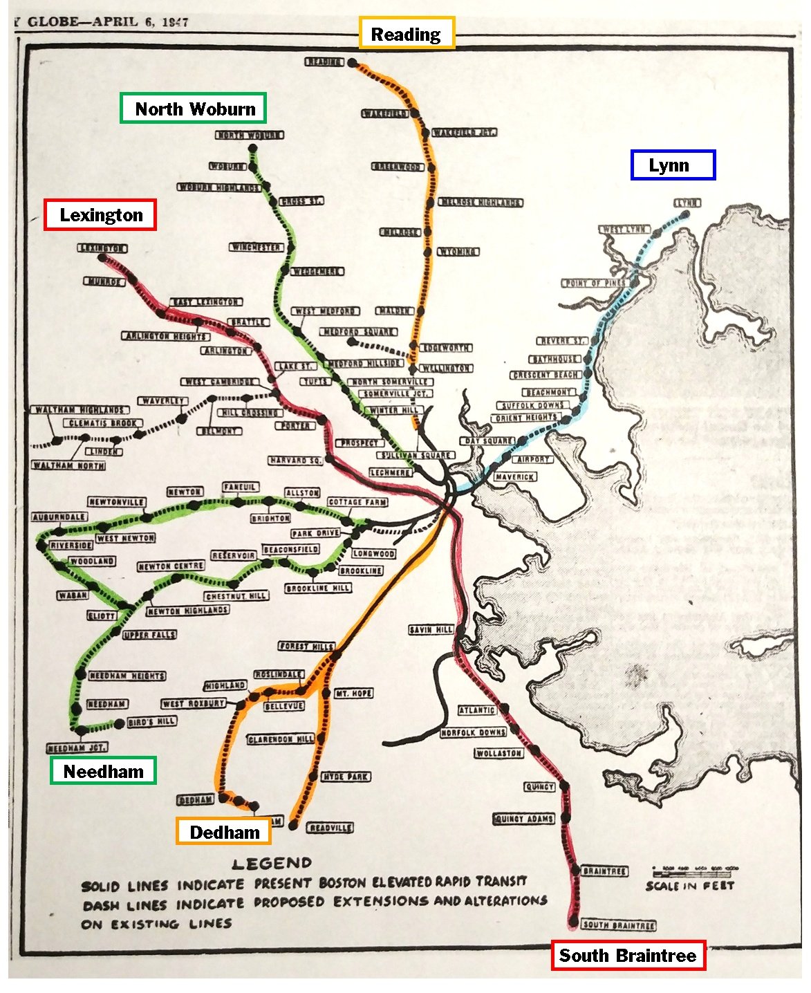
First, thank you, Emily Sweeney, for publicizing this 1947 map showing all the then-existing rapid transit lines along with proposed extensions. A few caveats and comments:
- The colors reflect the current names of the lines, not the names used in 1947.
- Note that most stations are not shown on the map — just enough to keep you oriented.
- Where’s the Ashmont branch of the Red Line? I thought it opened in 1928, well before this map.
- What did all the NIMBY folks in Lexington think of the idea of extending the Red Line north to Lexington? Note that it never happened.
Now fast-forward to 2019. We have two articles from Boston Magazine and one from Miles in Transit:
- the aforementioned 40 ideas to save Boston transportation in general
- a response and analysis from Miles Taylor and Ari Ofsevit
- an article by David Bernstein focusing specifically on rail transportation.
Check them all out for yourself. Note in particular that Miles and Ari wrote their responses independently, and yet they are remarkably in sync. Either they know each other really well from past collaboration or else it’s just that great minds think alike.
More transit, fewer cars! And that includes fewer Ubers and Lyfts. And fix the T, no matter what excuses the governor has for never riding it!
Categories: Dorchester/Boston
